Derwent
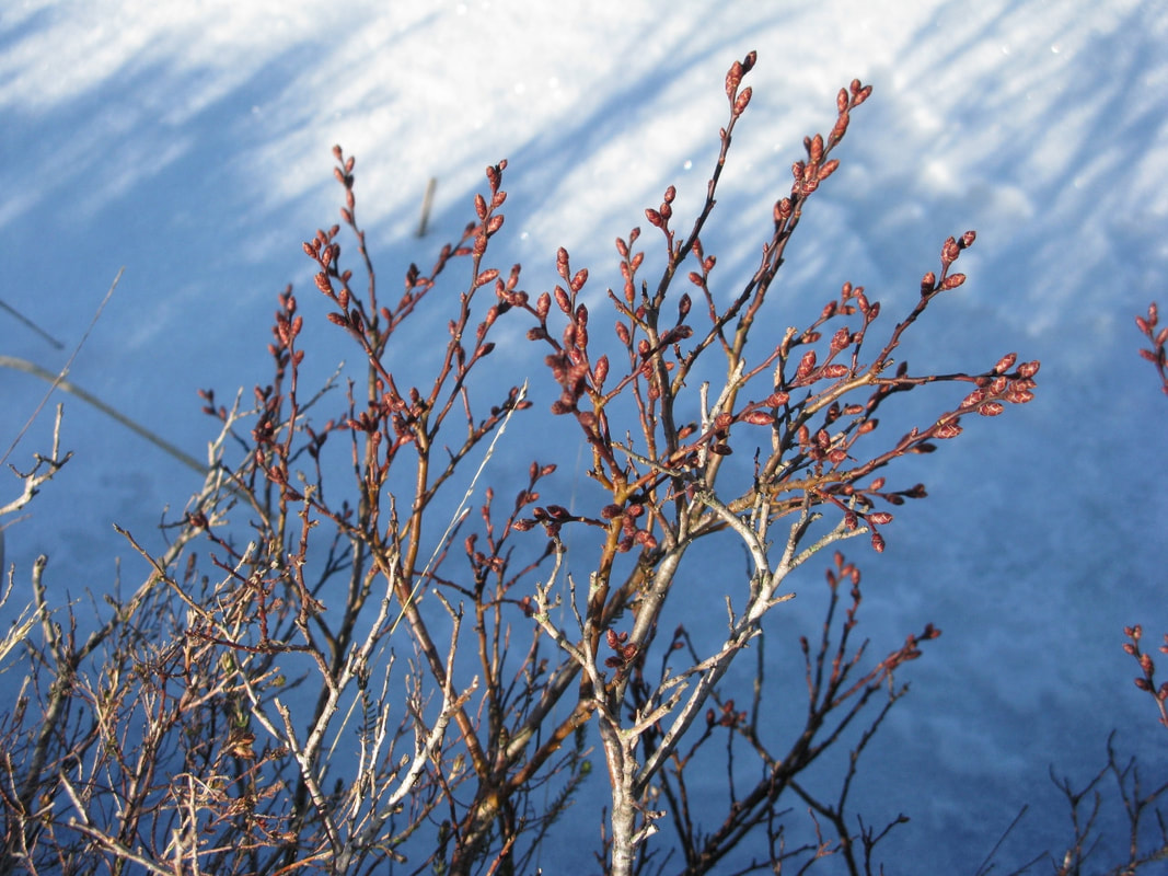
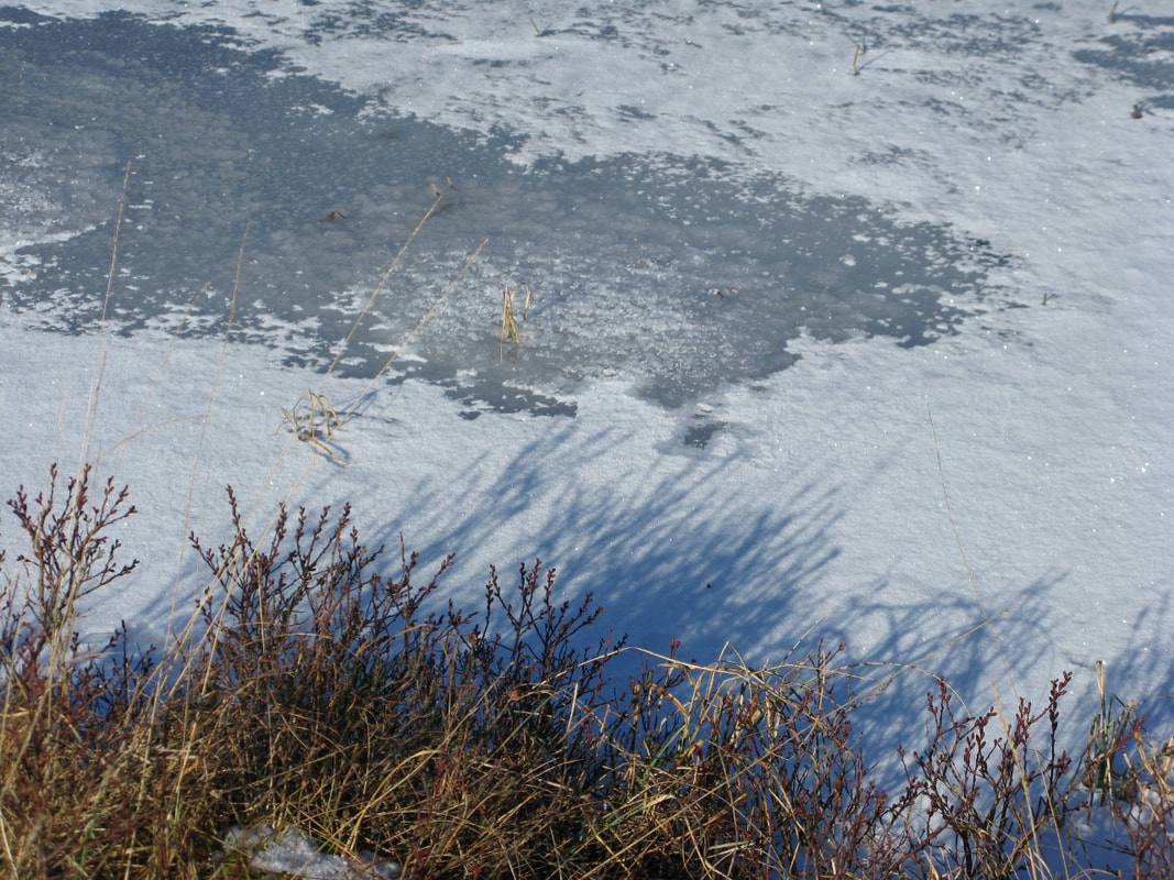
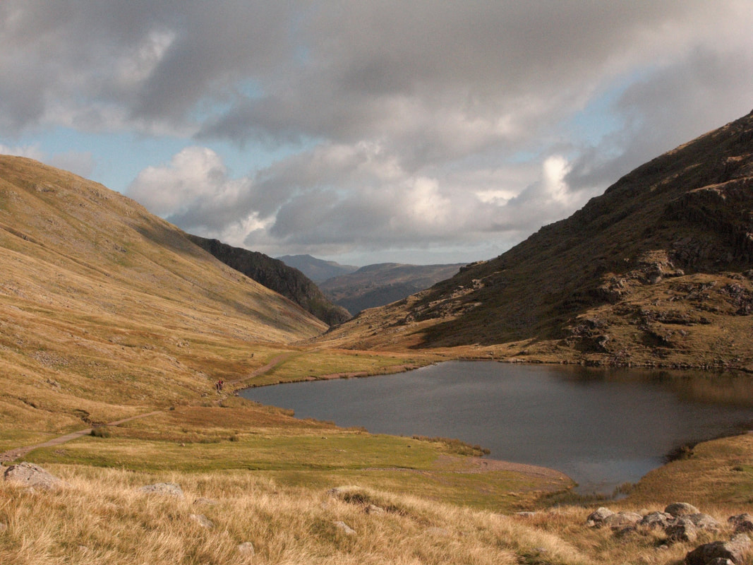
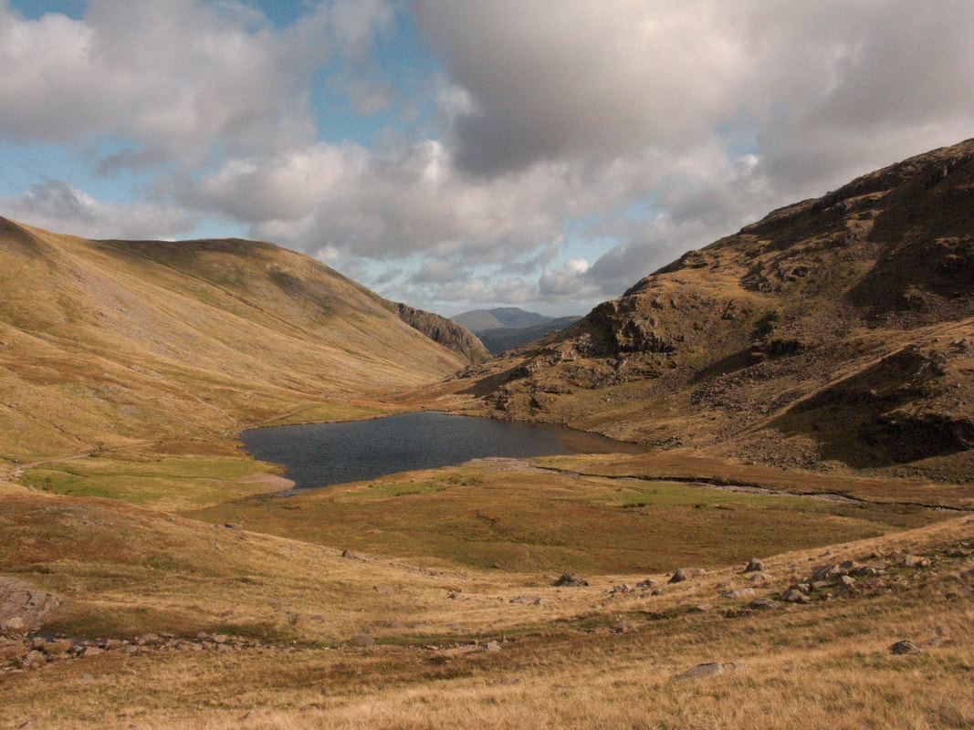
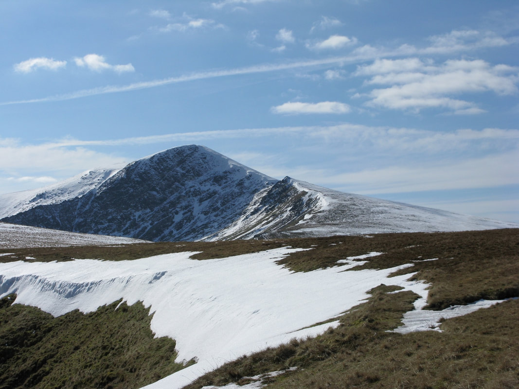 Blencathra from Bannerdale Crags 10 March 2010
From A Lakeland Experience: Derwent
Dramatic weather is one theme of this sequence of journals set in the River Derwent catchment. Floods in Cumbria. Tomasz Shafernaker interpreted the Exreme Weather event of November 2009. His cheery manner helps us through the darkest days.
The River Derwent was the focus as the heaviest rain fell in its catchment and towns along its course bore the brunt of the floods, highlighting how weather systems impact on the Cumbrian fells and how different river systems respond.
November 2009, Floods in Cumbria
A dismal, wet November with the ground already saturated when weather forecasters announced the imminence of an Extreme Weather Event - a category rarely designated. It would last from Tuesday 17 through Thursday 19.
Atlantic lows dominated, with a south-westerly wind blowing along the front and keeping it stuck over Cumbria. Currents of warm, moisture-laden air came in from the Azores and, blocked by the Cumbrian fells, rose rapidly, cooled, and then came precipitation. Orographic enhancement of rainfall: a standing wave. It rained and rained and rained over Cumbria.
As front after front piled in, the central fells experienced unprecedented rainfall. Rain fell relentlessly from 8.00pm on Wednesday until 5.00 am on Friday morning, when there was a brief respite. On the fells, winds were storm-force with gusts of over 100 mph, severe even at low levels. During 24 hours, 372 mm of rainfall was recorded by the rain-gauge at Seathwaite Farm: the highest ever. Off Scafell Pike and Great End, off Great Gable, off Glaramara and the Borrowdale Fells, cascading down becks and gills, seeking out adventitious channels, pouring straight off the fell-side, gushing down, a colossal volume of water overwhelming the network of becks that feed the large river system of the Derwent -one of the fastest flowing rivers in the country- by Seathwaite and Seatoller, by Rosthwaite and Grange-in-Borrowdale, through Derwentwater to meet the heavily-swollen River Greta gathering water off Blencathra and bursting its banks and causing flooding in Keswick, on through Bassenthwaite fed by becks off Skiddaw, laden with debris and battering bridges, heading for Cockermouth and its confluence with the River Cocker where the speed of the disaster was shocking to people living in Main Street who saw deep water racing by, and on to Workington where Northside Bridge had become unstable and in the darkness of 4.00 am PC Bill Barker, trying to direct traffic away from the bridge, was swept to his death as it collapsed. Swept down-stream to the Irish Sea, his body was discovered fifteen miles away on a beach at Allonby.
Thursday 19 November was a dark day.
At Cockermouth, the RAF sent in Sea King helicopters to rescue people, some through the roofs of flooded houses, and the RNLI evacuated people from Main Street. Lorton Bridge and the Southwaite foot bridge collapsed. All over the county the Mountain Rescue Services were ferrying police, doctors and social services to where they were needed: with ordinary vehicles unable to cope with the floods.
The rescue phase was concentrated on Thursday 19: the culmination of the extreme weather event. But there was scant respite, and a severe weather event with heavy rains and gale force winds was predicted for Tuesday 24 November: parts of the fells could collect up to 100 mm of rain, putting swollen rivers and beleaguered bridges under sustained pressure.
Army engineers helped check bridges and protect abandoned homes in Cockermouth. At Workington, Northside Bridge and a footbridge had gone and the Calva Bridge was unstable. Rivers were too high, too dangerous, to assess possible structural damage below the water-line. The emergency services were trying to move into recovery mode whilst under threat of the next severe weather event.
How do weathermen prepare us for what is to come? Tomasz Shafernaker mentioned the orographic emphasis, then declined to go further ‘enough of physics.’
Tuesday 24. A severe weather warning : 24 hours of persistent rain. 100mm on fells. SW winds with gusts up to 70 mph.’ Soggy weather.’
Wednesday 25. ‘Towering shower clouds, with hail. A squally, rattling front.’
Thursday 26 .’ Wind driven rain. From continuous rain to frequent showers:’
2009 saw the wettest November on record, with Cumbria recording the highest rainfall ever in 24 hours. The flood-hit towns are located along the course of the River Derwent on its journey to the Irish Sea. The river is designated a Site of Special Scientific Interest and it would take time to assess the impact of the November floods on the ecology of Cumbrian river systems.
The colossal power of water erosion caused landslips and landslides, with rivers rerouting, severe damage to river banks, boulders and rocks pounding and scouring river beds and dumped in fields along with millions of tons of gravel and silt. Some farmers had neither the man-power nor the resources to reclaim pastures that provide them with hay and silage – essential fodder for livestock. And there are evident tensions: farmers may be reluctant to lose productive land whilst an Environment Agency priority is to restore natural floodplains. ‘ Meandering rivers and functioning flood plains can hold water on the land, keeping it out of homes in times of flood.’ Thus ‘Future Water’, the government’s water strategy for England.
There is a history of flooding in the catchment of the River Derwent but, with climate change, intensity and frequency of rainfall is predicted to become more severe. How to put in place a response that is sustainable and effective? It’s a complex question and it is possible that no defence programme would entirely protect against an extreme weather event of such magnitude.

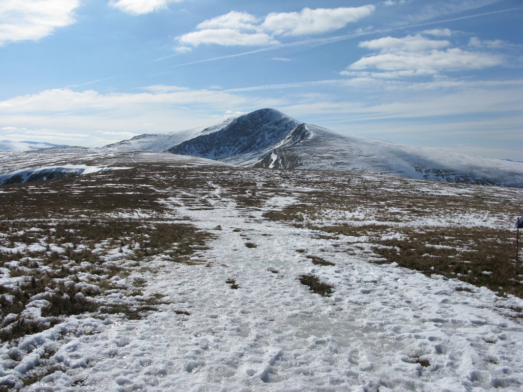
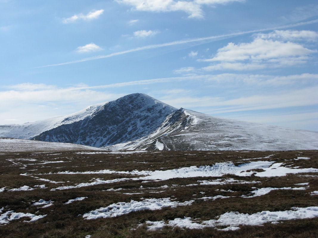
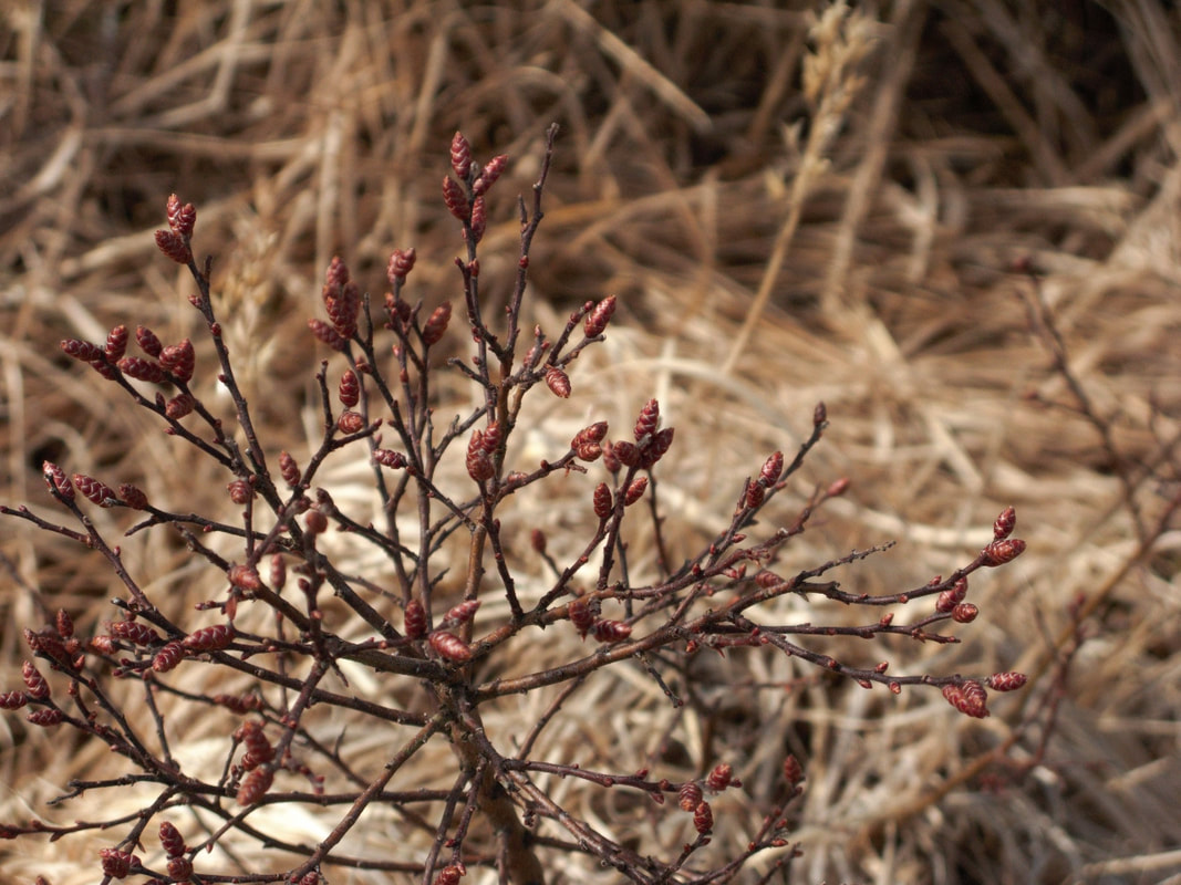
10 March 2010. Bannerdale Crags. Bowscale Fell
The March sun grew a little stronger, with days and days of high pressure. It was so still I could hear distant voices, but saw no one. A cornice of snow packed about the rim of the Bannerdale cirque. The frozen earth rang beneath my walking poles and skylarks sang. They were returned to the heights to breed, but what inhospitable terrain this moorland seemed for a ground-nesting bird. What food could they find here in March? Seen from the pile of stones on Bowscale Fell, Blencathra rose sunlit and the track gleamed with frozen prints- footsteps compacted in old snow. Dazzling sunlight reflected off snow on Saddleback, the col between the two high points of the mountain. White clouds gathered in the blue, and I heard the beat of ravens’ wings before the pair tumbled into view and disappeared over Blencathra.
Snow picked out a track below the arête of Sharp Edge: a spine of rock eroded and ground out by back-to-back glaciers. Coming down off Blencathra and picking a way over the jagged edge was a solitary figure.
10 April 2010 Brund Fell, Joppelty How , Dock Tarn
In the darkness, a pair of tawny owls called to each other and gradually they were lost to the dawn chorus and the first glimmer of light.
From Rosthwaite, I climbed up through chilly shadows and into the sun as I approached Joppelty How. There was clarity, with Bassenthwaite showing in the distance and streaks of snow on the northern fells. Heather habitat was the dominant motif of this walk, both on Brund Fell and around Dock Tarn. Frogspawn at the foot of a ladder stile! Not a good choice, Mrs Frog. Sometimes frogspawn appears where it hasn’t a chance.
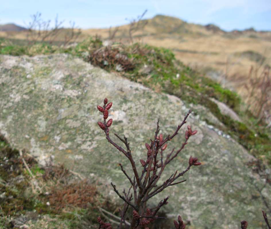
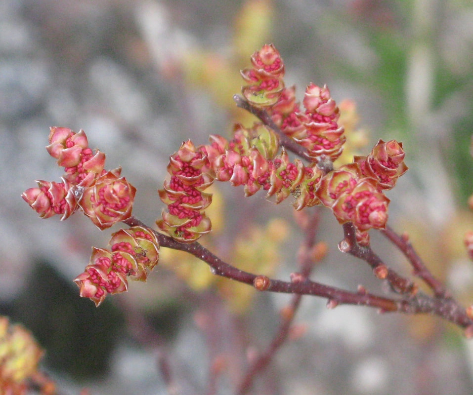
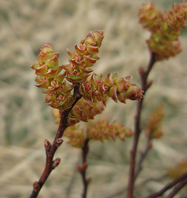
I had come seeking bog myrtle catkins, early to flower. Shrubs were abundant but catkin buds had been browsed, new shoots and buds nipped off. During a prolonged period of snow-cover this might be the only food source for sheep or deer. Toward Dock Tarn I found budding catkins but when should I return?
The landscape was in winter colour although the oak wood below Lingy End was green with mosses and the first wood sorrel flowers appeared.
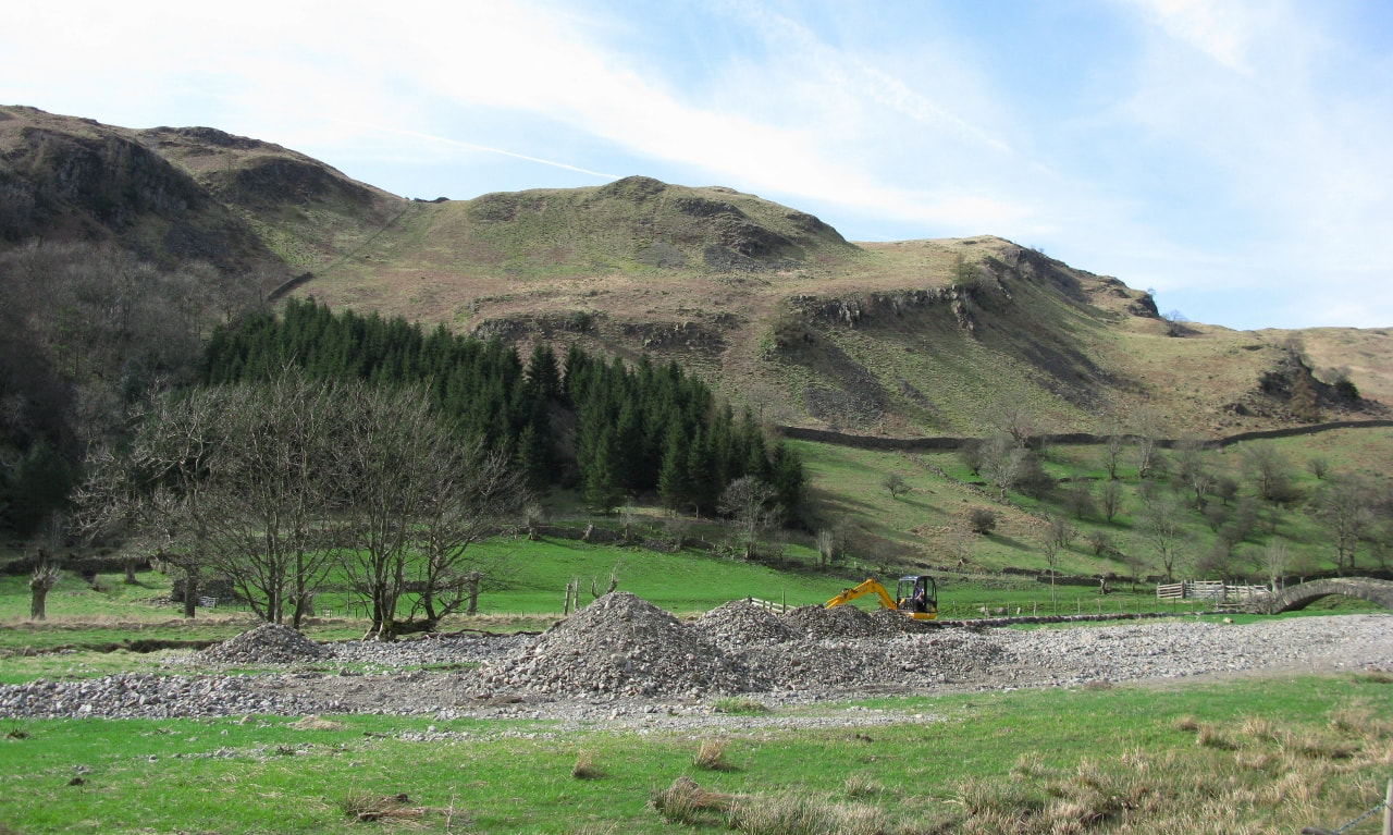
Homeward bound, via St Johns in the Vale , I stopped beside the beck to talk to a young farmer. They had bought a digger and were clearing mounds of rock and gravel, debris dumped during the November floods. Closer to the farm, sections of the bank of St John’s Beck had collapsed with a build-up of gravels and rock reaching under the bridge. They wanted to reclaim a hay meadow and to prevent major flooding in the future, but it’s a salmon river and he told me Natural England didn’t want it disturbed.
In the darkness, a pair of tawny owls called to each other and gradually they were lost to the dawn chorus and the first glimmer of light.
From Rosthwaite, I climbed up through chilly shadows and into the sun as I approached Joppelty How. There was clarity, with Bassenthwaite showing in the distance and streaks of snow on the northern fells. Heather habitat was the dominant motif of this walk, both on Brund Fell and around Dock Tarn. Frogspawn at the foot of a ladder stile! Not a good choice, Mrs Frog. Sometimes frogspawn appears where it hasn’t a chance.
I had come seeking bog myrtle catkins, early to flower. Shrubs were abundant but catkin buds had been browsed, new shoots and buds nipped off. During a prolonged period of snow-cover this might be the only food source for sheep or deer. Toward Dock Tarn I found budding catkins but when should I return?
The landscape was in winter colour although the oak wood below Lingy End was green with mosses and the first wood sorrel flowers appeared.
Homeward bound, via St Johns in the Vale , I stopped beside the beck to talk to a young farmer. They had bought a digger and were clearing mounds of rock and gravel, debris dumped during the November floods. Closer to the farm, sections of the bank of St John’s Beck had collapsed with a build-up of gravels and rock reaching under the bridge. They wanted to reclaim a hay meadow and to prevent major flooding in the future, but it’s a salmon river and he told me Natural England didn’t want it disturbed.
Saturday 17 April.
In Iceland, Eyjafjallajokull began to erupt during March, and by 15 April eruptions were more forceful, with plumes of ash. This volcano erupted through an ice cap, and exploded to create silica particles dangerous to aircraft engines. Jet aircraft must fly at high altitude for maximum efficiency, they could fly neither above nor below the cloud of volcanic ash and in an emergency they must descend through the ash without the specialist equipment to detect it. So the skies over Europe were shut down and there was a profound peace. Gin-clear skies were predicted, and a light westerly breeze. Up on Joppelty How there was no sign of this plume of ash ejected to some 33,000 feet but already depositing a layer of fine material on the ground in Shetland.
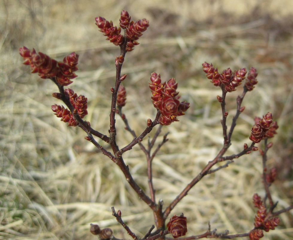
During the week there had been high pressure with warm weather and days of sunlight. Bog myrtle grew thick about outcropping rock with catkins of warm gold, full of pollen and aromatic. The outer casing of the bud tinged them rosy-brown and there were deep pink flowers whilst the leaf buds bided their time. Exquisite bog myrtle catkins. A vole or mouse scurried into the cover of a tussock of winter-pale grass. A pair of goosander swam on Dock Tarn.
In Iceland, Eyjafjallajokull began to erupt during March, and by 15 April eruptions were more forceful, with plumes of ash. This volcano erupted through an ice cap, and exploded to create silica particles dangerous to aircraft engines. Jet aircraft must fly at high altitude for maximum efficiency, they could fly neither above nor below the cloud of volcanic ash and in an emergency they must descend through the ash without the specialist equipment to detect it. So the skies over Europe were shut down and there was a profound peace. Gin-clear skies were predicted, and a light westerly breeze. Up on Joppelty How there was no sign of this plume of ash ejected to some 33,000 feet but already depositing a layer of fine material on the ground in Shetland.
During the week there had been high pressure with warm weather and days of sunlight. Bog myrtle grew thick about outcropping rock with catkins of warm gold, full of pollen and aromatic. The outer casing of the bud tinged them rosy-brown and there were deep pink flowers whilst the leaf buds bided their time. Exquisite bog myrtle catkins. A vole or mouse scurried into the cover of a tussock of winter-pale grass. A pair of goosander swam on Dock Tarn.

4 July 2007 Moor Farm, Castlerigg, Keswick, a farm walk
Moor Farm is situated on the A591 as it descends toward Keswick, an exposed location at about 200 metres, with vistas of Blencathra and Skiddaw. Robert Tyson has been tenant farmer since the National Trust took it on in 1996. He does shepherding at Mill Beck, just above the flood plain of the River Derwent, between Derwent Water and Bassenthwaite, where snow breaks sooner and grass grows two to three weeks earlier than up at Moor Farm.
The farmhouse is mid 18th century, its large barn early 20th century, and the Bellas family name appears on both. Mains water was brought to the farm comparatively recently and the original water supply to the farmhouse came from an unfailing spring toward Rakefoot, although there used to be a couple of months of the year when the water froze. Now the spring serves to water his cattle and a pipe runs across a pasture and down to the farm, bringing with it mice, rats, all sorts. Not far from the farmhouse are pollarded oaks, once serving as fodder for beasts. And he shows us an old hedge which will be replanted.
In the Foot and Mouth epidemic of 2001 his neighbour contracted the disease and so their animals were culled. In restocking, Robert had to introduce unhefted sheep to the fell and because it was unknown territory for the new arrivals he had to drive after them over hill and dale. He is fond of his dogs and needs them when sheep disappear in bracken. His beef cattle are sold at Penrith or Cockermouth and he has about a dozen heifers with a red bull sitting amongst them.
On Lake District hill farms much of the land has the SDA classification (Severely Disadvantaged Area) and Moor Farm is economically viable only because of single payment supplements. Higher Level Stewardship has been recently awarded for the species-rich hay meadows of Moor Farm, designated meadow by meadow, and Maurice Pankhurst of the National Trust was on hand to talk about flora. Low levels of nutrients are the key to the success of hay meadows- a habitat largely lost through use of fertiliser. With lower fertility no single species can dominate and greater diversity gives structure to a meadow, enabling plants to prop each other up in foul weather: diversity but not necessarily rarities. Yellow rattle is abundant, a semi-parasitic plant that attacks grasses, weakens them, and allows other plants to germinate. It’s an annual and if absent for more than a year or two, its seed bank is lost. At this season its inflated calyx is full of seeds, like a rattle. A range of grasses includes crested dog’s tail, with red and white clover, a yellow vetch, and slender tare with a delicate purple-blue pea flower. A curlew was calling and a peregrine flew by as swallows and house martins fed low about us. There should be butterflies and more open flowers but it had been cold and wet for such a while. We were in a phase of flood and rains, the influence of La Nina, and my tall wellingtons were perfect for farm walks.
By 24 July seed would have set so the hay meadows would be cut, the hay turned several times as it lay to distribute seed.
2 July 2010. Moor Farm, Castlerigg, Keswick. A farm walk, reprise.
Overnight rain cleared to give a fresh and beautiful morning with vistas of Blencathra. Since my last visit, farmer Robert Tyson ‘s hay meadow had been brushed by a machine that flicks seed into a bag and the farmer at High Snab in the Newlands Valley had had success with its germination. There was abundant yellow rattle in his meadows. Parasitic, it attacks grass, inhibits its growth so although the farmer likes his meadows they yield less of a crop. The introduction this year of Uplands ELS (Entry Level Stewardship) specifically recognises the high costs of farming the uplands and rewards the farmer with more generous payments.
The Met Office declared January to June 2010 to be the driest year since 1929 and I asked how sheep on Blencathra and Skiddaw would fare. There is not much water on the tops but hill sheep are hefted, and with this intimate knowledge of their patch they can find water. He pointed to a spot high on the flank of Skiddaw and described a sheep-trod leading to a place where water bleeds out of the ground, over a rock and disappears again- a reliable source. There had been hardly any dew this spring, the beck running through the Moor Farm pastures was almost dry and he had to leave field gates open so his cattle and sheep could reach the water troughs. To cope with the high rainfall in these fells there are old land drains, stone flagged, to get the water away.
The extreme weather this year continued to have a knock-on effect for Lake District farmers. Robert Tyson’s sheep had ‘an awful hungry time’ during the long, unusually harsh winter and his ewes were quite lean. Now with the drought the grass was ‘burnt out’ and not growing. Still reeling from the costs of fodder over a long winter, farmers were already looking to buy hay for the winter to come and ‘Farming Today’ declared that silage and hay crops could be 50% down. During the last two weeks of July and the first of August, Robert Tyson would make hay, and silage – should conditions be very wet. Last summer he made 150 small bales of hay, 160 of silage.
On 9 July 2010 a hosepipe ban came into force in Cumbria and it coincided with the coming of rain and flood alerts.


9th September 2010. Derwent Head , Seathwaite and Glaramara.
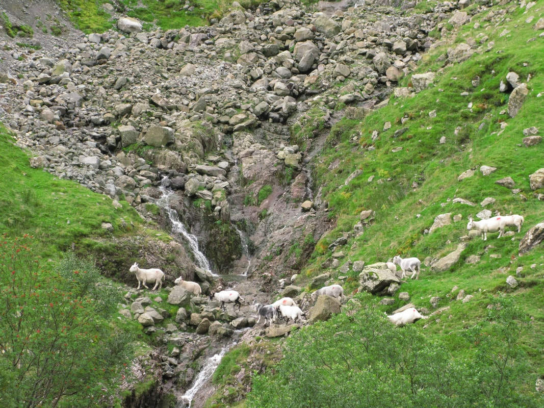
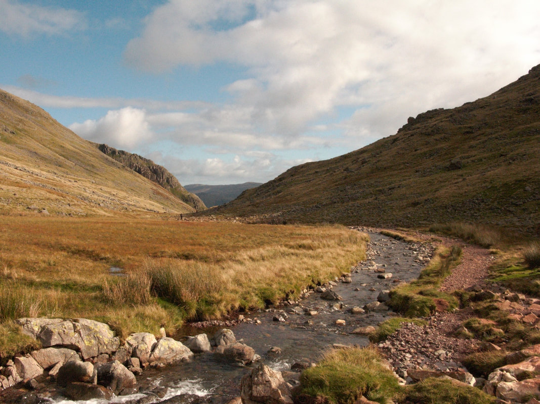
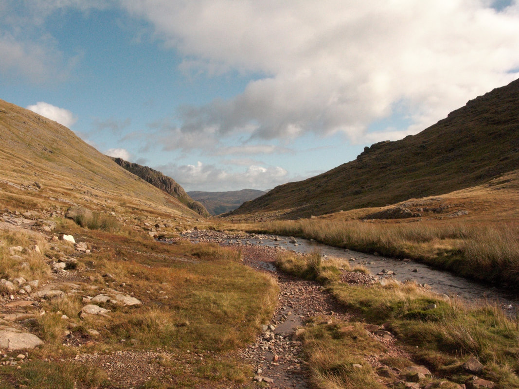
Above Seatoller, the River Derwent looked gentle enough, confined by a stone revetment as it flowed through pastureland, but above Derwent Head at the foot of Seathwaite Fell it changed its name and assumed a wilder character. Here Styhead Gill and Grains Gill came together and dumped their load of rock debris on the valley floor and the erosive power of water was visible all around.
Above Grains Gill, something I heard made me stop to contemplate a zone of crags, outcropping rock and screes below the summits of Glaramara: inhospitable terrain of an austere beauty. A series of green gashes showed where gills with waterfalls and chutes of rock debris poured off the fell. Most secret, most dramatic was Red Beck whose rock gorge breached the skyline and its twists and turns, its birch trees and waterfalls showed but dimly. The fell-profile changed where a grassy shelf underscored the steepest ground, and below came friable material dumped by a glacier and since cut through with watercourses draining down to Grains Gill and the Derwent. Here the ground appeared green, in a rhythm of upturned rowing boats- their hulls rippled with fine-ground earth.
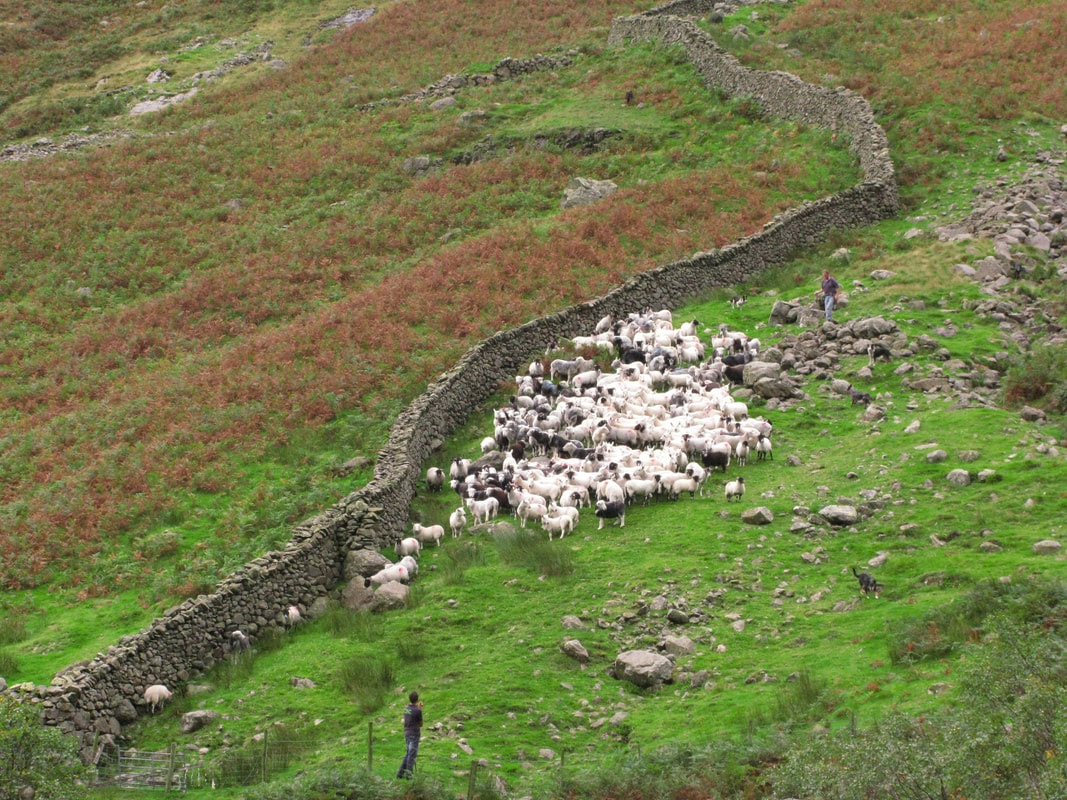
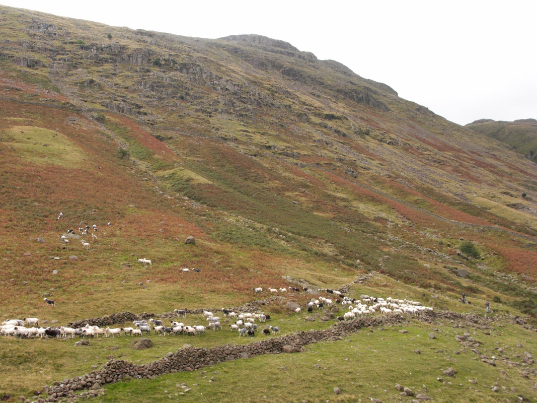
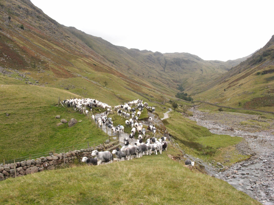
I like to be responsive to what the day offers. I might head up onto the Glaramara ridge or I might not - in cloud it was not irresistible and this was a fresh perspective. I was looking into secret places, the domain of shepherds whose calls I heard long before I could find them. Below the skyline, sheep appeared with tell-tale spurts of movement, driven by unseen dogs. Somewhere high on the ridge shepherds were gathering and in this rugged terrain they assumed a mythic presence- those evocative cries might have come from the Viking settlers who imposed their farming traditions on these fells and named the features of its landscape: fell, force, gill, beck, tarn and dale are of Old Norse origin. How might they gather their scattered sheep and bring them safely down into the dale? Red Beck gorge was a hazard to be avoided but maverick ewes scrambled up out of the lower reaches of the gill whilst others trotted down along the bank. Like long ropes of pearls, kinking and spilling, sheep came down beside a green-gash gully, crossed at the grassy terrace, swung north and contoured single-file toward an eroded basin littered with rock and scree where Red Beck met Grains Gill. Voices echoed up on the flanks of Glaramara, coming out of the cloud, shepherds with their dogs were gathering wayward ewes and lambs which had been on the fell all summer. As they descended their whistles and calls became clearer, an urgent ‘lie down, lie down’ then a sequence of oaths in a rough language suited to the landscape- was that Old Norse too? They shrugged off centuries as they became distinct. Two shepherds and their dogs brought up the rear as their flock passed a sheep-fold and came together before an intake wall for a time of respite: horned Swaledales, the black pearls of Herdwick lambs and their silver-white mothers, and ewes with Etruscan profile and erect ears. They set off again along the terrace toward Stockley Bridge and the track down to Seathwaite Farm.
Stockley Bridge lies on a popular route, and here came a collision of tourism and hill farming with walkers heading up the dale as the flock headed down. Twelve dogs in mottled seal-skin camouflage closed in behind sheep gathered above the bridge and pouring down onto the footpath. Spooked by a walker, they broke away down the bank and across Grains Gill, dogs in pursuit and splashing through water and rock-debris as a third shepherd gathered them in.
I fell into conversation with a young couple, their child sleeping on his father’s back, and as the flock made slow progress along the footpath we kept in the rear. The family was staying at a cottage in Seatoller and, like me, they were awed by the skill of men and dogs bringing their sheep off this steep and rugged fellside. Here was the gritty reality of pastoral. From those distant and elusive calls how they take on substance! A gang of three shepherds and a dozen dogs gathering off Glaramara!
Back at Seathwaite farm, with the sheep penned, I chatted to one of the shepherds and heard that they would be gathering on surrounding fells for the next few days. They were to separate lambs from ewes, keeping all the females- this year’s lambs would not mate but would be left to grow out first. All was silent and I wondered if the dogs were back in their wooden sheds beside the toilets.
Above Seatoller, the River Derwent looked gentle enough, confined by a stone revetment as it flowed through pastureland, but above Derwent Head at the foot of Seathwaite Fell it changed its name and assumed a wilder character. Here Styhead Gill and Grains Gill came together and dumped their load of rock debris on the valley floor and the erosive power of water was visible all around.
Above Grains Gill, something I heard made me stop to contemplate a zone of crags, outcropping rock and screes below the summits of Glaramara: inhospitable terrain of an austere beauty. A series of green gashes showed where gills with waterfalls and chutes of rock debris poured off the fell. Most secret, most dramatic was Red Beck whose rock gorge breached the skyline and its twists and turns, its birch trees and waterfalls showed but dimly. The fell-profile changed where a grassy shelf underscored the steepest ground, and below came friable material dumped by a glacier and since cut through with watercourses draining down to Grains Gill and the Derwent. Here the ground appeared green, in a rhythm of upturned rowing boats- their hulls rippled with fine-ground earth.
I like to be responsive to what the day offers. I might head up onto the Glaramara ridge or I might not - in cloud it was not irresistible and this was a fresh perspective. I was looking into secret places, the domain of shepherds whose calls I heard long before I could find them. Below the skyline, sheep appeared with tell-tale spurts of movement, driven by unseen dogs. Somewhere high on the ridge shepherds were gathering and in this rugged terrain they assumed a mythic presence- those evocative cries might have come from the Viking settlers who imposed their farming traditions on these fells and named the features of its landscape: fell, force, gill, beck, tarn and dale are of Old Norse origin. How might they gather their scattered sheep and bring them safely down into the dale? Red Beck gorge was a hazard to be avoided but maverick ewes scrambled up out of the lower reaches of the gill whilst others trotted down along the bank. Like long ropes of pearls, kinking and spilling, sheep came down beside a green-gash gully, crossed at the grassy terrace, swung north and contoured single-file toward an eroded basin littered with rock and scree where Red Beck met Grains Gill. Voices echoed up on the flanks of Glaramara, coming out of the cloud, shepherds with their dogs were gathering wayward ewes and lambs which had been on the fell all summer. As they descended their whistles and calls became clearer, an urgent ‘lie down, lie down’ then a sequence of oaths in a rough language suited to the landscape- was that Old Norse too? They shrugged off centuries as they became distinct. Two shepherds and their dogs brought up the rear as their flock passed a sheep-fold and came together before an intake wall for a time of respite: horned Swaledales, the black pearls of Herdwick lambs and their silver-white mothers, and ewes with Etruscan profile and erect ears. They set off again along the terrace toward Stockley Bridge and the track down to Seathwaite Farm.
Stockley Bridge lies on a popular route, and here came a collision of tourism and hill farming with walkers heading up the dale as the flock headed down. Twelve dogs in mottled seal-skin camouflage closed in behind sheep gathered above the bridge and pouring down onto the footpath. Spooked by a walker, they broke away down the bank and across Grains Gill, dogs in pursuit and splashing through water and rock-debris as a third shepherd gathered them in.
I fell into conversation with a young couple, their child sleeping on his father’s back, and as the flock made slow progress along the footpath we kept in the rear. The family was staying at a cottage in Seatoller and, like me, they were awed by the skill of men and dogs bringing their sheep off this steep and rugged fellside. Here was the gritty reality of pastoral. From those distant and elusive calls how they take on substance! A gang of three shepherds and a dozen dogs gathering off Glaramara!
Back at Seathwaite farm, with the sheep penned, I chatted to one of the shepherds and heard that they would be gathering on surrounding fells for the next few days. They were to separate lambs from ewes, keeping all the females- this year’s lambs would not mate but would be left to grow out first. All was silent and I wondered if the dogs were back in their wooden sheds beside the toilets.


Friday 17 September A week of unsettled weather intervened before a north west wind brought a day of clarity, strong light and defining shadow. I had hoped to revisit the Seathwaite Farm gatherings, having nudged my camera onto a wrong setting. Conditions looked good for photography, I was attracted by those upturned boats of glacial debris, so I was back.
Sunlight caught drifts of red gravels washed-up along the sculpted bedrock of Styhead Gill striated by the passage of the glacier, and the heaped stones of a cairn glowed fiery red. On Aaron Slack, descending between Green Gable and Great Gable, the colour of ferric oxide showed on eroding banks. Red Beck and Ruddy Gill- their names declared the minerals found in these Borrowdale Volcanic rocks .
As I reached Styhead Tarn there came an hour of wondrous light, illuminating and throwing into relief the outcropping rocks of Seathwaite Fell, cobalt on pools amongst peat hags, claret coloured sedges and bright greens about the margins of the tarn filling with sediments deposited by the beck flowing down the fellside.
On the watershed, I stood looking toward Scafell Pike, remembering Coleridge’s descent of the rock face of Broad Stand on 5 August 1802 . In ‘Coleridge Early Visions’ Richard Holmes conveys the intensity of the experience and his relationship to the mountain. I went down into the gorge of Ruddy Gill, amongst rock shelves and pools, with rose root spilling down rock, with alpine alchemilla, ferns and great woodrush .
The profile of the U- shaped valley opened up before me, a peregrine flew over the ridge and cloud-shadow and waves of sunlight washed down the Glaramara fell-side where the melting glacier had dumped its debris in smooth-shaped moraines. A steep spur overlooking Allen Gill led me into a domain of gills and waterfalls and, finding myself in an auditorium, I sat and listened to the waters of Glaramara and Seathwaite Fell, with fresh motifs drawn into the symphony- a cadence of waves: wind, water and rock in a fusion of flowing, always a flux and flow. I could see the way falling water imprinted on Glaramara, to etch and incise through crags, through outcropping rock with boulder-strewn gills, always the drag of gravity, losing gradient and shelving where it met glacial moraines and scouring and scooping along my spur and all along the beached rowing boats below me. At my feet fine red earth was exposed and the soft flanks of the spur showed the underlying ripple effect of fine-ground material. Falling, and an arrested falling. Water falls over rock in a burst of air bubbles, rock seems arrested: until the next storm. The muffled sounds of water music bear a percussive loosening of rock, a shift and drag, always drawn relentlessly downward in this landscape of elemental force and energy, down Allen Gill and Grains Gill into the River Derwent, through Derwentwater, and at last to the Irish Sea.
Wild weather and the mountain on the move: venture out in storm force winds and the impact on one’s own body would be the core experience - to stand up, to keep one’s eyes open, to breathe would be a challenge and the assault on the ear would render sounds indistinguishable. What we see in the landscape is the aftermath, the calm after the storm.
If sheep could talk what might they tell of rock fall and slippage, rainfall and gales, of winter snows, of being out on the fells on dark and stormy nights when shepherds and sheep dogs are safely back at the farm? Those hefted Herdwicks introduced by the Viking farmers have inherited an intimate knowledge of their patch of fell – and survival skills. The sheepdogs too, have bloodlines that go back a long way. The fells are their inheritance, in their genes. They have a profound experience of the landscape, a sense of place, a bonding.