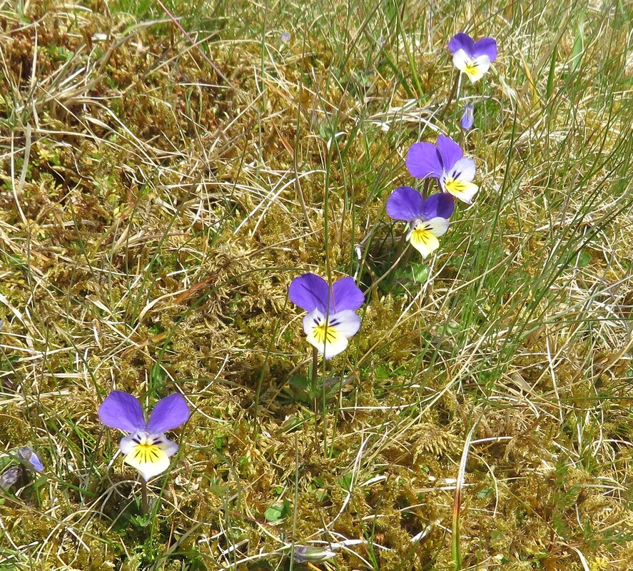
 Viola tricolor, wild pansy, heartsease
 As a nature writer, I like to study an OS map for the natural history embedded in place names and landscape features. A history of natural history.
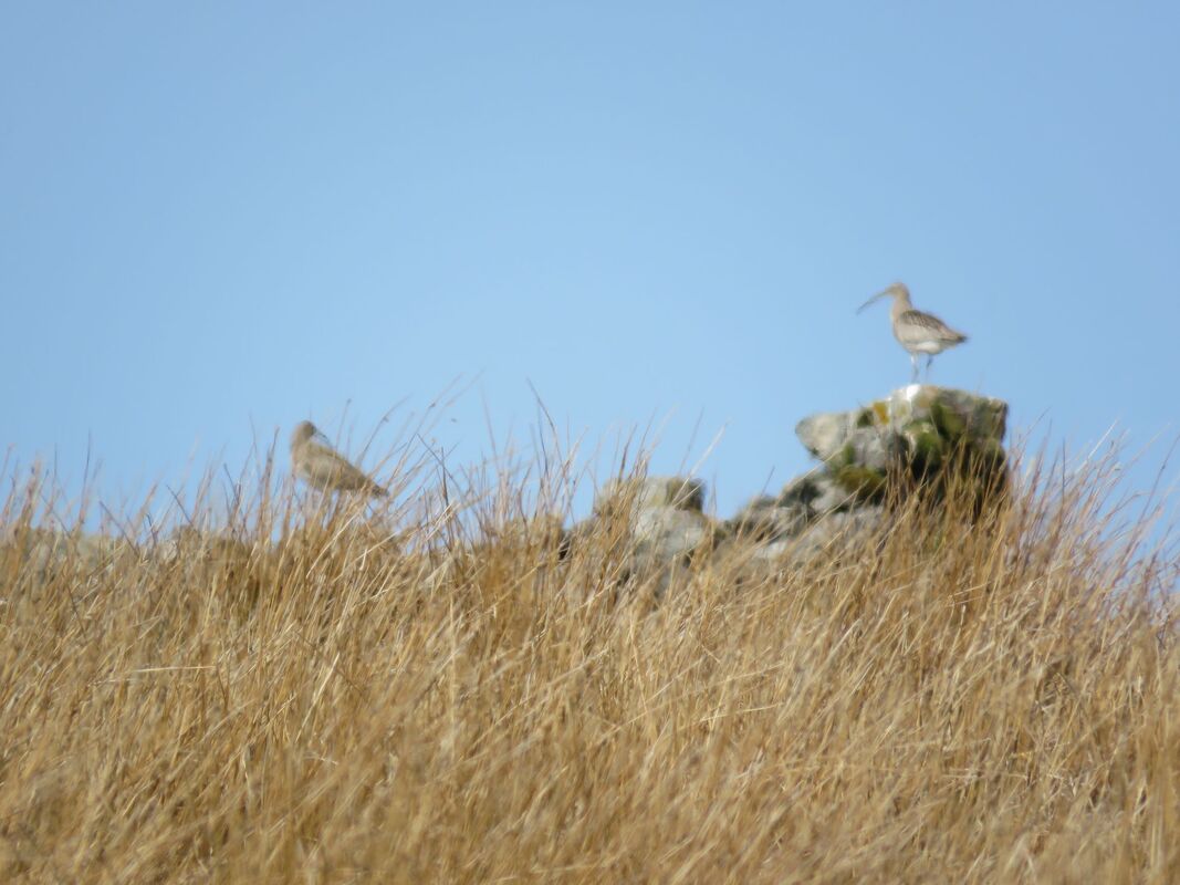
Looking back on the day, I match our findings with what the map tells of habitat and species. Bents Sike is a burn flowing through boggy pastures of rush, sedge and rough grass. *Bents Head is the last intake bordering Moss Moor. Lapwing call all around us, in display flight descending with an audible clapping of wings. Snipe rise from sedges in zig-zag flight. Curlew are calling and a pair perches on a ruined sheepfold outlined against the sky. When they fly, a meadow pipit takes the stand. Songs of spring surround us.
Looking back on the day, I match our findings with what the map tells of habitat and species. Bents Sike is a burn flowing through boggy pastures of rush, sedge and rough grass. *Bents Head is the last intake bordering Moss Moor. Lapwing call all around us, in display flight descending with an audible clapping of wings. Snipe rise from sedges in zig-zag flight. Curlew are calling and a pair perches on a ruined sheepfold outlined against the sky. When they fly, a meadow pipit takes the stand. Songs of spring surround us.
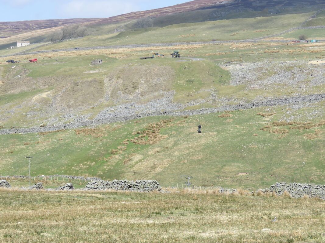
Moss Moor and Plover Hill rise above intakes bounded by a stone wall. It’s open moorland of grass tussocks interspersed with heather and the sphagnum mosses of peat bog. Plover Hill will be named for golden plover rather than lapwing whose habitat is the sedge pastures of Bents Head. No idea when the name Plover Hill appeared on the OS map, so with decline in numbers will golden plover still be here in this place? We hope so A row of grouse butts shows by Plover Hill.. They're mapped frequently, and, historically, these moors have long been managed for red grouse which are found here throughout the year. Unlike golden plover which return to the high moors in spring, to breed. Our path follows a stone wall that marks a boundary between pastures and open moorland, so aurally we’re in a transitional zone- between red grouse, and curlew and lapwing. It’s a beautiful morning so we sit on a boulder and immerse ourselves in the day. Rivers of sphagnum moss are dried-out because of a prolonged dry spell through April. Hearing the plaintive call of golden plover, we listen and listen, scanning the horizon and every raised feature where the bird might show. One flies above us, calling. Golden plover must once have been abundant here- for Plover Hill to be so named- a traditional breeding ground. Perhaps there is a breeding population here- impossible to know from a single visit. Grass tussocks are habitat for voles, the prey of short-eared owl which does not show this morning. But chance is the thing- I've learnt that whilst studying birds on my local patch. There can be an interlude when it's all happening, then silence falls, there is nothing to see and it's as if there's nothing there.
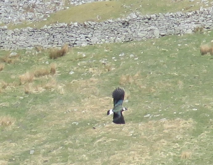

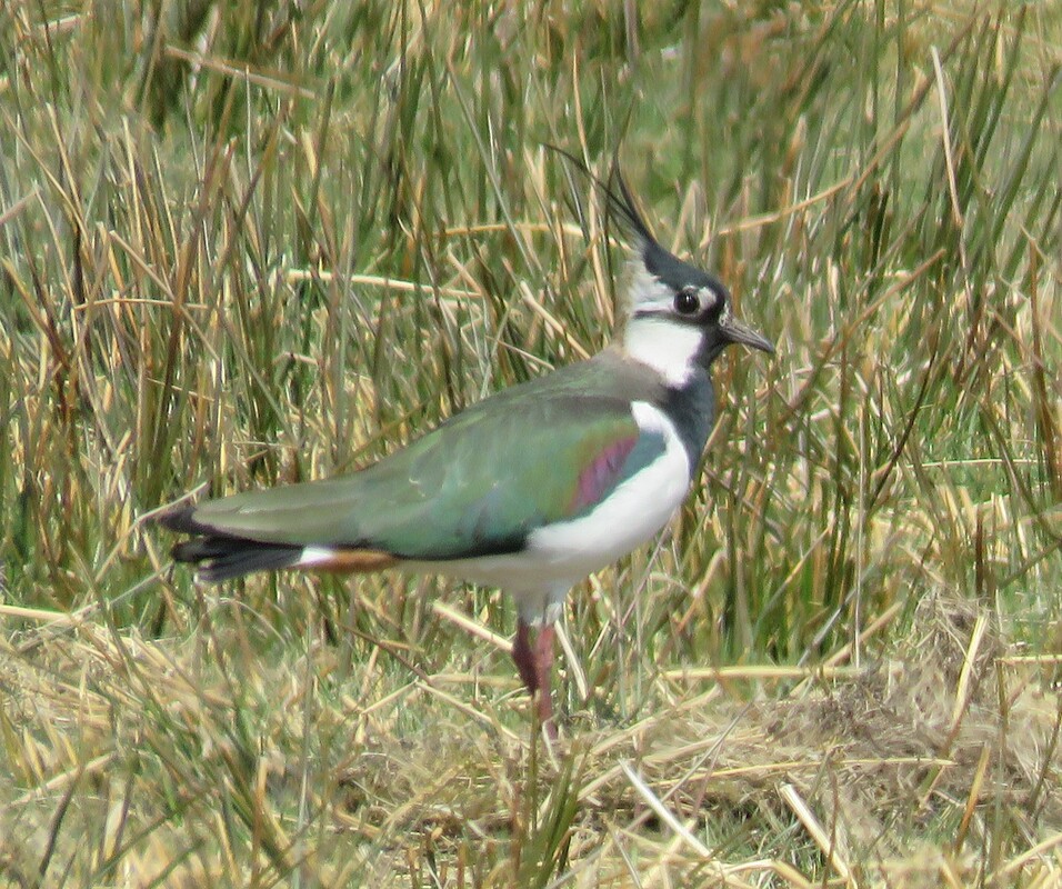
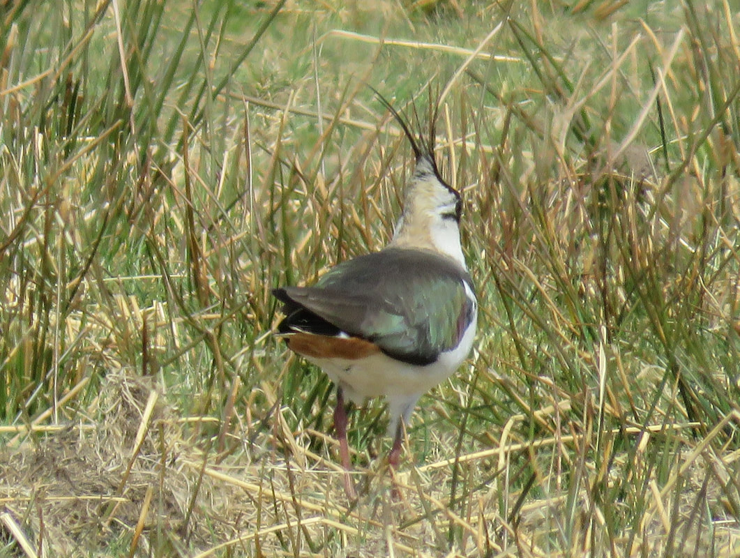
Heading down to the River Wear, there’s a clamour of lapwing. A pheasant struts through a pasture and lapwing defend their nest sites, crying loud and diving low over the pheasant to drive it off Strong sunlight highlights an iridescent green on the mantle of the lapwing They are ground-nesting birds so their eggs are vulnerable to a strutting and heavy-bodied pheasant. They are so agitated by the threat posed by the pheasant we may stand half-hidden behind a stone wall and watch the drama close-by.
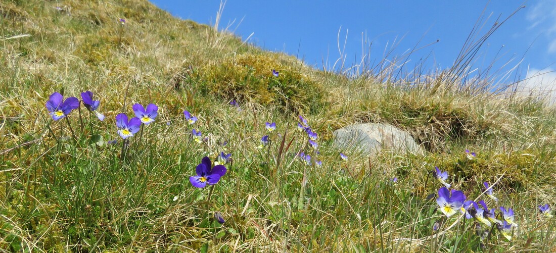
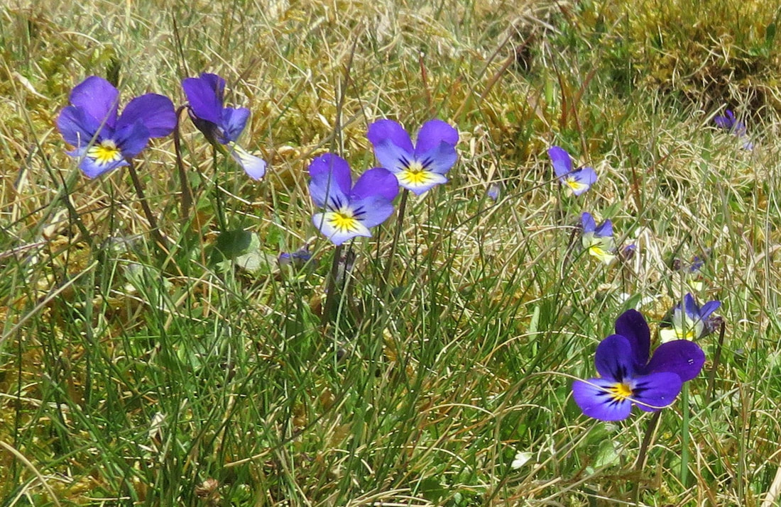
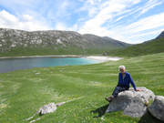
At Killhopeburn Bridge we cross the River Wear and follow a riverside track, finding viola tricolor on grassy banks. The path runs close beside the river but at Heatherycleugh a worn-looking sign warns ‘danger, eroded bank’. A landslip has scoured out bank and track. It’s not recent but there are no diversion signs so we have to work out how to reach Heathery Bridge. The fine April weather is yet to break and the river is low so it’s over a barbed wire fence (a crossing-point sheathed in plastic) and across the river’s stony bed, over a shifty stone wall, up a steep bank to and fro. Focused on route-finding and negotiating a sequence of obstacles there are no photographs. At last, we join the Weardale Way, cross a bridge at Low Allers and dodge bikers thrill-seeking over the high North Pennine roads. There’s a lower, quiet road overlooking a lake in a disused quarry and we enjoy a very late lunch sitting on a bench looking out toward Moss Moor and Plover Hill.
How about Rough and Ready where three county boundaries coincide? I am asked. The sun has vanished and it’s chilly on this exposed road at Killhope Cross, watershed for the rivers Nent, Allen and Wear. We walk north through heather and sphagnum moss seeking the point where three county boundaries meet at 648 metres: : County Durham, Northumbria and Cumbria. This is heather moorland and peat bog where sausage-shaped plugs lie across peat gullies to hold back heavy rainfall so it is absorbed by sphaghum mosses. The cackle of red grouse and the song of meadow pipit are the only sounds.
The OS map shows Rough and Ready is an Old Lead Shaft. The moor is scattered with disused shafts, disused quarries, disused mine-workings, disused pits. And grouse butts. There’s a trace of snow on Cross Fell and when the weather changes during the week Cross Fell gleams under fresh snow. Red and white poles road-side warn of depths of snow. It’s not a picturesque landscape, Rough and Ready is stern and bleak in character. Here is wilderness and solitude, welcome after the restrictions of lockdown. Wilderness with a potent sense of history. Silent now but imagine the scene with mining in full swing at Rough and Ready. We have the luxury of sitting in the last of the sun, in the shelter of our vehicle eating fruit cake and drinking hot chocolate at Slate Hill, Killhope Cross. Kill hope, abandon hope all ye who enter here?
If we linger until summer we could head south, following a wall to 668 metres and Knoutberry Hill. The name indicates that cloudberry grew there once, perhaps still does. It’s a lovely flower and I’d like to know who named the hill and when.
* BENTS Shorter Oxford Dictionary
BENTS Meadow of stiff grass. Name given to grass of a reedy habit. To various grass-like reeds, rushes, sedges.
a definition that accords with the Bents Head habitat
KNOUTBERRY, Cloudberry, Rubus chamaemorus
 RSS Feed