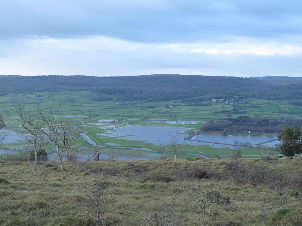
 From Burnbarrow Scar, looking west across the Lyth Valley to Whitbarrow. 29 December 2015
 Storm Frank strikes Cumbria and southern Scotland and we batten down the hatches, again. The winds whip up during the night, rattling windows, unseen. We are newly aware of geography, of the rivers of northern England. We mastermind on the jet stream, on Atlantic weather systems, rainfall intensity and river catchment because they impact on us: with homes and businesses flooded and travel disrupted. Don’t travel today if you don’t have to, Radio Cumbria advises. Once more, there’s concern for Keswick, Braithwaite and Glenridding as the winds gather strength and up to 130 mm of rainfall is expected. And nearby Glencoyne, How fare the farmers at Glencoyne?
I write in the darkness before dawn and December days dawn reluctantly in these storms off the Atlantic. I’ll not see the Lyth Valley again until storm Frank has passed. Until then, darkness will prevail. .
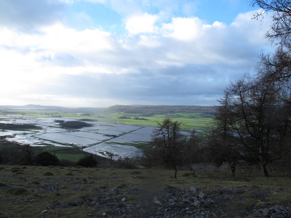
Flood waters in the Lyth Valley, from Helsington Barrows looking south toward Morecambe Bay
Yesterday, up on Scout Scar, sunlight came gradually with lurid light on green pastures emerging from flood water. I revisit in the manner of David Hockney, the same scene: looking west over Brigsteer hidden below Burnbarrow Scar, where Helsington Pool snakes across the Lyth Valley close to the drowned road . An aerial view of a man-made landscape that the floods seek to take back to its natural state of wetland. The same, and never the same. The flood water rises and falls. The road approaching the barn and hump-backed bridge is lost under water for much of December, then appears briefly before being drowned again. Sunlight and blue sky is reflected in flood water, for moments on a good day. Otherwise, the scene lends itself to black and white photography. Everyone heads for Scout Scar because a good day is a rarity, and travel is disrupted. No crossing the Lyth Valley to walk on Whitbarrow this month.
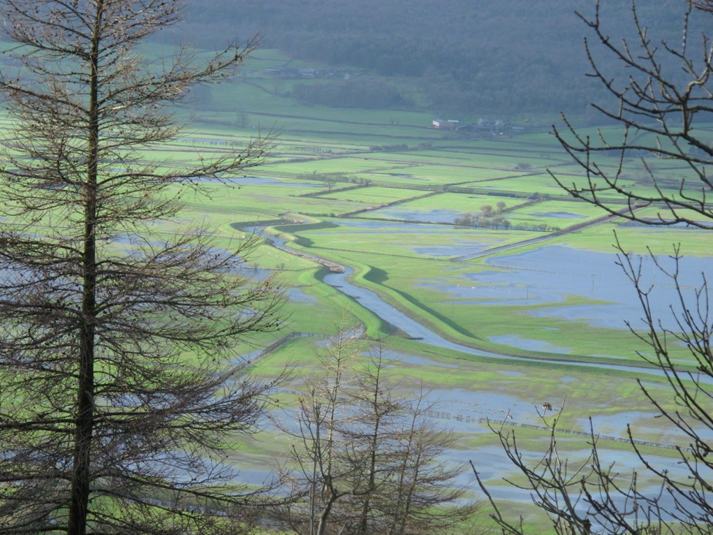

Helsington Pool, with embankments, cutting across the picture. And the road centre right.
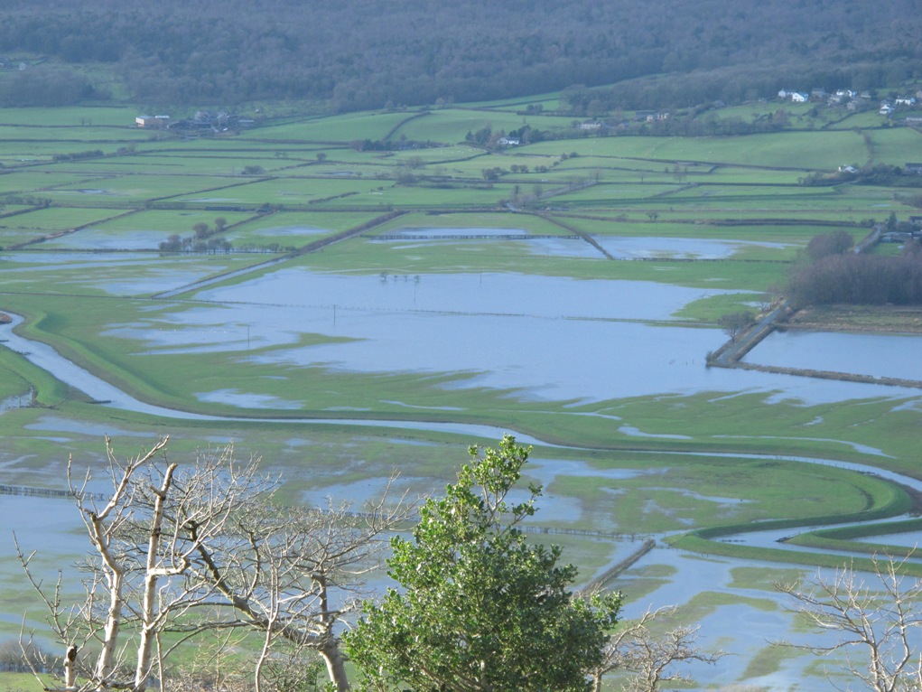
River, pool and drain dominate. And pumps, when the pumping system is operative. It’s controversial, whether to spend money on keeping it going in the Lyth Valley when there is flooding in urban areas. This landscape is all about drainage. Today, the sun highlights the embankments built high above Helsington Pool. Deep ditches on either side of the road, all over-topped and drowned.
To the south of Helsington Pool comes the Brigsteer Causeway, to give farmers access to their fields. The engineering, the planning of this landscape, when enclosure came to the Lyth Valley early in 19 century is fascinating. No aerial photography to help them plan. The view from Scout Scar and Whitbarrow must have been invaluable.
To the south of Helsington Pool comes the Brigsteer Causeway, to give farmers access to their fields. The engineering, the planning of this landscape, when enclosure came to the Lyth Valley early in 19 century is fascinating. No aerial photography to help them plan. The view from Scout Scar and Whitbarrow must have been invaluable.
And all the while what no one is seeing, cannot see, is the impact on wildlife. From Scout Scar I can't even make out what happened to all those sheep stranded high on the Helsington Pool embankment. And what happened to cattle and pigs at Savinhill Farm?
 RSS Feed